How to Read a METAR: The Complete Decoding Guide
A METAR is a coded weather observation issued by an airport or automated station, usually once an hour, that tells you exactly what the weather is doing right now at that field. Learning how to read a METAR means learning a fixed sequence of fields that always appear in the same order: report type, station, time, wind, visibility, weather, clouds, temperature, pressure, then remarks. Once you know the order, you can decode any report in seconds, even one packed with cumulonimbus, freezing drizzle, and a gusting crosswind.
This guide walks every field in order, covers both the international (ICAO) and US (FAA) conventions that trip people up, and ends with fully decoded examples and a remarks (RMK) reference that most beginner guides skip entirely.
Want the fast version? MetarMaster decodes any live report into plain English the instant it loads, tap any group to see what it means, and a risk engine scores the field while showing every reason behind the call. Use this guide to understand the why, and let MetarMaster do the reading for you in the cockpit. Try it at metarmaster.com.
Table of contents
- The anatomy of a METAR
- 1. Report type: METAR or SPECI
- 2. Station identifier
- 3. Date and time (Zulu)
- 4. Report modifiers: AUTO, COR, AO1, AO2
- 5. Wind
- 6. Visibility and RVR
- 7. Present weather
- 8. Sky condition and clouds
- 9. Temperature and dew point
- 10. Altimeter and pressure
- 11. Remarks (RMK)
- 12. Trend and forecast groups
- 13. Runway conditions, wind shear, and sea state
- 14. Military color codes
- 15. Flight category color codes
- Worked examples
- Common mistakes when reading a METAR
- METAR vs TAF: what's the difference?
- Frequently asked questions
The anatomy of a METAR
Every METAR follows one fixed template. The fields are space-separated and always appear left to right in the same order:
METAR STATION DDHHMMZ AUTO/COR WIND VISIBILITY WEATHER CLOUDS TEMP/DEW PRESSURE RMK ...
Here is a real-looking report we will decode piece by piece throughout this guide:
METAR EHLE 280925Z AUTO 21009G19KT 060V130 5000 -RA FEW007 BKN014CB BKN017 02/M01 Q1001 BECMG 6000
Read in plain English, that says: an automated observation from Lelystad Airport, taken on the 28th at 09:25 UTC, wind from 210 degrees at 9 knots gusting 19, variable between 060 and 130 degrees, visibility 5,000 meters, light rain, a few clouds at 700 feet, broken cumulonimbus at 1,400 feet, broken at 1,700 feet, temperature 2 C with a dew point of minus 1 C, altimeter 1001 hectopascals, and visibility becoming 6,000 meters.
Now let's break down each field so you can do that yourself.
1. Report type: METAR or SPECI
The report opens with its type.
- METAR is the routine, scheduled observation, normally issued every hour or half hour.
- SPECI is a special, unscheduled observation triggered by a significant change between routine reports, such as a sudden wind shift, a visibility drop, or the onset of a thunderstorm.
Many modern stations issue updated observations so frequently that SPECI is used less than it once was, but you will still see it when conditions change abruptly. In the US, the leading word "METAR" is often omitted entirely and the report simply begins with the station identifier.
2. Station identifier
Next comes the four-letter ICAO identifier for the airport or station.
EHLEis Lelystad Airport in the Netherlands.KORDis Chicago O'Hare. In the contiguous US the ICAO code is the familiar three-letter FAA identifier with aKprefix.PHNL(Honolulu) andPANC(Anchorage) show how the prefix changes outside the lower 48.
The first one or two letters encode the region, which is why nearly every US station starts with K, most Canadian stations with C, and European stations with E or L.
3. Date and time (Zulu)
The timestamp is a six-digit group followed by Z: 280925Z.
- The first two digits are the day of the month (28th).
- The next two are the hour on a 24-hour clock (09).
- The last two are the minutes (25).
Zmeans Zulu time, the aviation term for Coordinated Universal Time (UTC), time zone zero.
Both the date and the time are in UTC, never local time. This is deliberate: a single shared time reference removes any ambiguity when an aircraft, a controller, and a dispatcher are in three different time zones. So 280925Z is the 28th at 09:25 UTC.
4. Report modifiers: AUTO, COR, AO1, AO2
An optional modifier can follow the time:
- AUTO means the observation was generated automatically with no human augmentation. Automated reports have known blind spots, which is why the remarks section will usually clarify the station's sensor capability (see AO1 and AO2 below).
- COR means this is a corrected report that replaces a previously transmitted one.
- NIL means no report data is available.
In the remarks section of US automated reports you will also find the station type:
- AO1 is an automated station without a precipitation discriminator. It can tell that precipitation is falling but not what type.
- AO2 is an automated station with a precipitation discriminator, so it can distinguish rain from snow.
These two codes are the single most common thing beginner guides leave out, and they matter, because an AO1 station's weather group is less trustworthy than an AO2's.
5. Wind
The wind group reads dddff(f)Gff(f)KT, optionally followed by a variability range.
Decoding 21009G19KT 060V130:
- 210 is the direction the wind is blowing from, in degrees true, rounded to the nearest ten.
- 09 is the sustained speed, 9 knots.
- G19 is the gust, peaking at 19 knots. Gusts are only reported when the peak exceeds the sustained speed by 10 knots or more.
- KT is the unit, knots. Some countries use
MPS(meters per second) orMPHinstead. - 060V130 means the direction was variable between 060 and 130 degrees. A variable range is reported only when the direction varied by 60 degrees or more while the speed stayed above 6 knots.
A few special cases:
- 00000KT is calm.
- VRB03KT means a variable direction at 3 knots, used when speed is 6 knots or less, or when the wind is genuinely directionless.
- /////KT means the wind sensor data is missing.
Two important caveats for pilots. Wind direction in a METAR is always true, while the tower gives you magnetic wind for the active runway, so the two will differ by the local magnetic variation. And the wind is measured roughly 33 feet (10 meters) above the surface, so it tells you nothing about winds aloft, which are usually much stronger.
6. Visibility and RVR
This is the biggest split between the two conventions, so read carefully.
International (ICAO) visibility is reported in meters. 5000 means 5,000 meters of prevailing visibility. Values below 1,000 are padded to four digits, and 9999 means 10 km or more.
US (FAA) visibility is reported in statute miles with the suffix SM. 3SM is three miles, 1/2SM is half a mile, and 10SM is the practical ceiling for "unlimited."
When visibility is poor, individual runways report RVR (Runway Visual Range), a sensor-measured value along the runway itself, usually appearing once visibility drops below about 2,000 meters or 1 mile:
R23/0500Runway 23 RVR is 500 meters.R23/P0500RVR is more than (Plus) 500 meters, above the sensor's max.R23/M0500RVR is less than (Minus) 500 meters, below the sensor's min.R23/0500V1500RVR is variable between 500 and 1,500 meters.R23/0500URVR is 500 meters and trending Up;Dwould be down,Nno change.
In the US, RVR is reported in feet, for example R06R/2000FT.
7. Present weather
Weather phenomena are built from up to three parts in a strict order: intensity or proximity, then descriptor, then phenomenon. -RA is light rain: the - is intensity, RA is the phenomenon. +SHRA is heavy rain showers: + intensity, SH descriptor, RA phenomenon.
Intensity / proximity
| Code | Meaning |
|---|---|
+ |
Heavy |
- |
Light |
| (none) | Moderate |
VC |
In the vicinity (within 5 to 10 miles, not at the field) |
RE |
Recent (since the last report) |
Descriptors
| Code | Meaning |
|---|---|
MI |
Shallow |
PR |
Partial |
BC |
Patches |
DR |
Low drifting |
BL |
Blowing |
SH |
Showers |
TS |
Thunderstorm |
FZ |
Freezing |
Phenomena
| Code | Meaning | Code | Meaning | |
|---|---|---|---|---|
RA |
Rain | FG |
Fog | |
DZ |
Drizzle | BR |
Mist | |
SN |
Snow | HZ |
Haze | |
SG |
Snow grains | FU |
Smoke | |
GR |
Hail (> 5 mm) | DU |
Widespread dust | |
GS |
Small hail (< 5 mm) | SA |
Sand | |
PL |
Ice pellets | VA |
Volcanic ash | |
IC |
Ice crystals | PO |
Dust/sand whirls | |
UP |
Unknown precip | SQ |
Squalls | |
DS |
Dust storm | FC |
Funnel cloud | |
SS |
Sandstorm | PY |
Spray |
Combination rules worth memorizing:
- The most significant precipitation is listed first.
SHRAGSis showers with more rain than small hail. FZ(freezing) pairs only withRA,DZ, andFG, and means it freezes on contact with a surface. Freezing precipitation is a flight hazard, not a footnote.MI,BC, andPRare used only with fog.DRandBLapply only to snow, sand, and dust.- The distinction between FG and BR is visibility: fog is below 1,000 meters, mist is at or above it. BR vs HZ: above 80 percent humidity it is mist.
8. Sky condition and clouds
Cloud layers are reported low to high, each as a coverage code plus a three-digit height in hundreds of feet above the station.
Coverage (in eighths, or "oktas")
| Code | Coverage |
|---|---|
FEW |
1 to 2 oktas |
SCT |
Scattered, 3 to 4 oktas |
BKN |
Broken, 5 to 7 oktas |
OVC |
Overcast, 8 oktas |
Decoding FEW007 BKN014CB BKN017:
FEW007few clouds at 700 feet.BKN014CBbroken at 1,400 feet, and these are cumulonimbus (thunderstorm clouds).BKN017broken at 1,700 feet.
The ceiling is the lowest broken or overcast layer, here 1,400 feet. Only two cloud types are ever called out by name: CB (cumulonimbus) and TCU (towering cumulus), because both signal convective hazard. Three slashes after a layer, like BKN013///, mean an automated station could not determine the type.
Vertical visibility and clear-sky codes
VV002vertical visibility of 200 feet, used when the sky is obscured (for example, in dense fog) and no distinct layer can be measured.SKCsky clear, observed by a human.CLRno clouds detected below 12,000 feet by an automated station.NCDno cloud detected (automated).NSCno significant cloud below 5,000 feet and nothing convective above.
CAVOK ("Ceiling And Visibility OK") is a shorthand that replaces the visibility, weather, and cloud groups all at once. It requires visibility of 10 km or more, no cloud below 5,000 feet (or the highest minimum sector altitude, whichever is greater), no cumulonimbus or towering cumulus at any level, and no significant weather. With CAVOK, our example collapses to:
METAR EHLE 280925Z 21009G19KT 060V130 CAVOK 02/M01 Q1001
9. Temperature and dew point
Temperature and dew point are reported in whole degrees Celsius, separated by a slash, with M prefixing negative values: 02/M01 is 2 C with a dew point of minus 1 C.
Two things this field tells you beyond the obvious:
- Fog and icing risk. The closer the dew point is to the temperature, the higher the relative humidity. A small spread with falling temperatures is a setup for fog or, near freezing, for ice. A 1 to 2 degree spread is worth your attention.
- Density altitude. High temperature plus high field elevation thins the air and degrades climb and takeoff performance. The METAR temperature is your starting input for that calculation, and MetarMaster's offline cockpit tools compute density altitude and crosswind for you, even with no signal.
10. Altimeter and pressure
The pressure setting lets you set your altimeter correctly, and again the convention splits by region:
Q1001is 1001 hectopascals (the ICAO standard, also called QNH).A2994is 29.94 inches of mercury (the US standard).
Both refer to sea-level pressure (QNH), the value you dial into your altimeter so it reads field elevation on the ground. The Q form dominates internationally; the A form dominates in the US and Canada.
11. Remarks (RMK)
Everything after RMK is the remarks section, and in the US this is where a huge amount of useful detail lives. Most beginner guides stop before this point. Here are the codes you will actually encounter:
- AO1 / AO2 station type, as covered above.
- PK WND 28045/1538 peak wind of 45 knots from 280 degrees at 15:38 UTC.
- WSHFT 1530 a wind shift occurred at 15:30 UTC.
- SLP134 sea-level pressure of 1013.4 hPa. The decoder rule: prepend
9or10to make the value land near 1000, so134reads as 1013.4 and984reads as 998.4. - P0009 liquid precipitation since the last hourly report, in hundredths of an inch, so 0.09 inches.
- T00171028 the precise temperature and dew point to a tenth of a degree. The leading digit of each group is the sign (0 = positive, 1 = negative): here +1.7 C and -2.8 C.
- 10142 the 6-hour maximum temperature (14.2 C); 21001 the 6-hour minimum (-0.1 C).
- 51012 the 3-hour pressure tendency, here rising 1.2 hPa.
- TSB24E50 thunderstorm began at :24 and ended at :50.
- FG SCT008 can reappear in remarks to clarify automated observations.
A typical US tail might read RMK AO2 SLP134 T00171028, which decodes to: automated station with precipitation discriminator, sea-level pressure 1013.4 hPa, temperature 1.7 C, dew point minus 2.8 C.
12. Trend and forecast groups
International METARs can append a short trend forecast describing the next two hours. (US observations do not; in the US this role belongs to the separate TAF, covered below.)
- BECMG 6000 "becoming," a lasting change, here visibility becoming 6 km.
- TEMPO BKN007 a temporary fluctuation lasting under an hour, here a broken layer at 700 feet.
- FM1200, TL1200, AT1200 the change occurs from, until, or at that time.
- PROB30 / PROB40 a 30 or 40 percent probability of the change that follows. Lower probabilities are not reported, and anything more likely is stated outright rather than with PROB.
13. Runway conditions, wind shear, and sea state
Wind shear
WS R23wind shear reported on the approach or departure path for runway 23.WS ALL RWYwind shear affecting all runways.
Runway state group (after snow or ice), formatted like R05/629294:
R05runway 05.6deposit type (here slush).2contamination coverage (11 to 25 percent).92deposit depth (10 cm).94braking action (medium to good).
Deposit types run 0 (clear and dry) through 9 (frozen ruts), coverage from 1 (10 percent or less) to 9 (51 to 100 percent), depth codes where 92 is 10 cm and 99 means the runway is closed, and braking from 91 (poor) to 95 (good), with 99 meaning the figures are unreliable. The special code R/SNOCLO means the airport is closed due to snow or ice.
Sea state (offshore platforms): W12/S8 is sea-surface temperature 12 C with a wave state of 8 on a 0 (calm) to 9 (phenomenal) scale.
14. Military color codes
Military aerodromes often append a color code summarizing visibility and ceiling instead of a civilian trend.
| Code | Visibility | Ceiling |
|---|---|---|
| BLU Blue | > 8 km (5 mi) | > 2,500 ft |
| WHT White | 5 to 8 km | 1,500 to 2,500 ft |
| GRN Green | 3.7 to 5 km | 700 to 1,500 ft |
| YLO Yellow | 1.6 to 3.7 km | 300 to 700 ft |
| AMB Amber | 0.8 to 1.6 km | 200 to 300 ft |
| RED Red | < 0.8 km | < 200 ft |
A sequence like GRN AMB TEMPO RED reads as: currently Green, forecast to become Amber, temporarily Red. A BLACK prefix means the field is closed for reasons unrelated to weather, so BLACKGRN is a closed field whose conditions are otherwise Green.
15. Flight category color codes
This is the summary most pilots reach for first. The four US flight categories are derived from ceiling and visibility only, and they say nothing about wind, temperature, or convective hazards.
| Category | Ceiling | Visibility |
|---|---|---|
| VFR Visual Flight Rules | > 3,000 ft | > 5 SM |
| MVFR Marginal VFR | 1,000 to 3,000 ft | 3 to 5 SM |
| IFR Instrument Flight Rules | 500 to below 1,000 ft | 1 to below 3 SM |
| LIFR Low IFR | < 500 ft | < 1 SM |
A field falls into the most restrictive category that either its ceiling or its visibility triggers. So 4,000-foot ceiling with 2 SM visibility is IFR, not VFR, because visibility governs. UNKN means the data is incomplete or expired.
Worked examples
Example 1, a calm clear morning (US):
METAR KAUS 291153Z 00000KT 10SM CLR 18/14 A3001 RMK AO2 SLP163 T01780139 10189 21172
Austin-Bergstrom, 29th at 11:53 UTC, calm wind, 10 statute miles visibility, sky clear below 12,000 feet, 18 C over 14 C dew point, altimeter 30.01 inHg. Remarks: automated with precip discriminator, sea-level pressure 1016.3 hPa, precise temperature 17.8 C and dew point 13.9 C, 6-hour max 18.9 C, 6-hour min 17.2 C. Flight category VFR.
Example 2, a low IFR winter morning (US):
METAR KORD 291251Z 04012KT 1/2SM R10L/2000FT -SN FZFG VV004 M03/M04 A2987 RMK AO2 SLP118 P0001 T10331039
O'Hare, 29th at 12:51 UTC, wind from 040 at 12 knots, half a mile visibility with runway 10L RVR at 2,000 feet, light snow and freezing fog, vertical visibility 400 feet (sky obscured), minus 3 C over minus 4 C, altimeter 29.87 inHg. Remarks: automated with discriminator, sea-level pressure 1011.8 hPa, 0.01 inches of precipitation, precise temperature minus 3.3 C and dew point minus 3.9 C. Flight category LIFR, and freezing fog plus snow makes this a genuinely hazardous field.
Example 3, a thunderstorm in the vicinity (international):
METAR EHAM 291225Z 25018G30KT 4000 VCTS +SHRA SCT012 BKN025CB 19/16 Q1008 TEMPO 1500 TSRA
Amsterdam Schiphol, 29th at 12:25 UTC, wind 250 at 18 gusting 30 knots, 4,000 meters visibility, thunderstorm in the vicinity with heavy rain showers, scattered at 1,200 feet, broken cumulonimbus at 2,500 feet, 19 C over 16 C, 1008 hPa. Trend: temporarily 1,500 meters with thunderstorm and rain.
Common mistakes when reading a METAR
- Confusing meters with statute miles. A bare
5000is meters (ICAO);5SMis miles (US). Mixing them up changes your read by a factor of three. - Reading the wind as magnetic. METAR wind is true; tower wind is magnetic. They differ by local variation.
- Ignoring the dew point spread. A tight spread with cooling is a fog and icing forecast hiding in plain sight.
- Stopping before the remarks. The RMK section in US reports carries sea-level pressure, precise temperatures, peak winds, and precipitation totals.
- Trusting an AO1 weather group. A station without a precipitation discriminator cannot reliably tell rain from snow.
- Treating flight category as the whole picture. VFR by ceiling and visibility can still mean a gusting crosswind or embedded convection.
Practice what you've learned with MetarMaster
Reading a guide gets you the rules. Repetition makes them automatic, and that is exactly what MetarMaster is built for. It is a pilot-built app that turns every report you pull into both a briefing and a lesson.
- Plain English, instantly. Every group is translated the moment the report loads, so
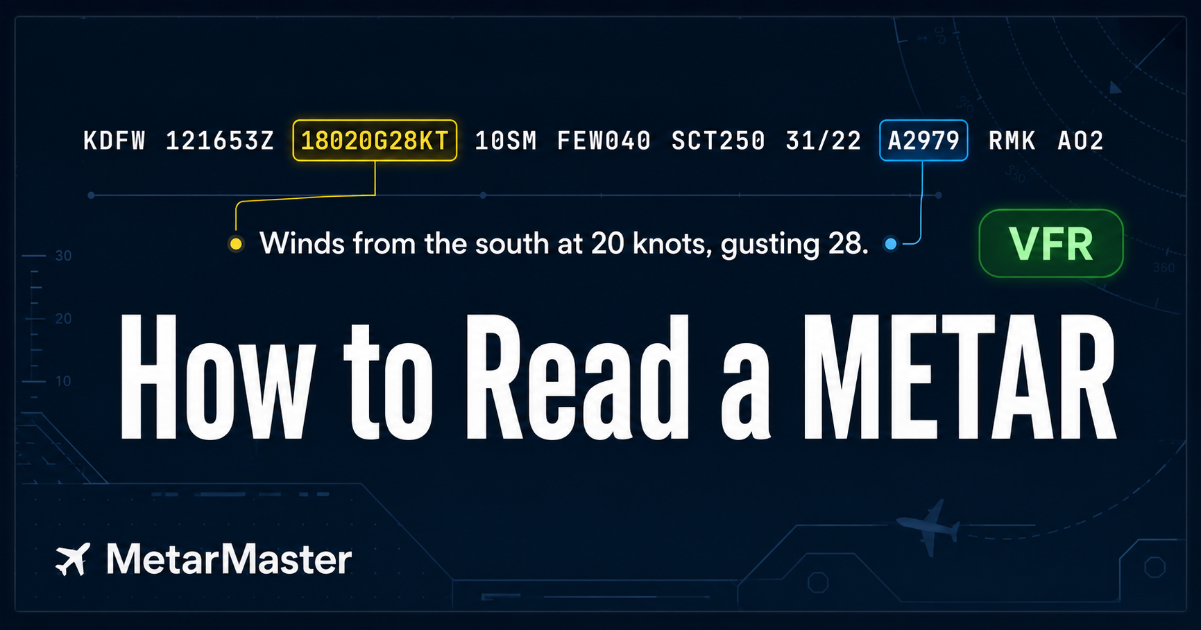
18020G28KTbecomes "winds are from the south at 20 knots gusting 28." - Tap to decode. Tap any group in the raw report to see exactly what it means, from
SCT055toA2979, without leaving the screen. - A risk engine that shows its work. Each field is scored Low to Severe, with every contributing reason listed every time and your own personal limits factored in, for example "your max gust is 25 kt, current gusts are 28 kt." Never a black box.
- Learn Mode. Quizzes are generated from the real, live METAR you just read, not canned textbook examples. Earn XP, hold a daily streak, and climb the ranks, and every wrong answer comes with the why, like why
FEWandSCTare never ceilings. Five minutes a day beats one cram before the checkride. - The big picture. A national map of flight categories with radar, infrared satellite, SIGMETs, and airspace, all color-coded, plus one-line route briefings that check every reporting airport in your corridor.
- Honest data. Report time, fetch time, and age in minutes are always shown, and stale reports are flagged, never passed off as current. Data comes from the AviationWeather.gov API.
- Works offline. The cockpit tools decode AWOS and ATIS you copy by ear and compute crosswind and density altitude with no connection.
It is free forever, ad-supported, with an ad-free tier at $1.99 a month or $9.99 a year that supports an independent, pilot-built app. Built for iPhone and Android, with shareable web links that open in any browser. Start at metarmaster.com.
MetarMaster is for education, training, and situational awareness only. It is not a substitute for an official weather briefing, flight service, or pilot judgment. Always verify weather with official sources before flight.
METAR vs TAF: what's the difference?
A METAR is an observation, a snapshot of current conditions at one station. A TAF (Terminal Aerodrome Forecast) is a forecast for the next 24 to 30 hours within roughly five statute miles of the airport. They share most of the same coding, which is why decoding one teaches you the other, but a METAR tells you what is while a TAF tells you what is expected. Pilots read both: the METAR to know the present, the TAF to plan the arrival.
Frequently asked questions
What does the Z in a METAR mean?
The Z stands for Zulu time, the aviation name for Coordinated Universal Time (UTC). Every date and time in a METAR is in UTC, never local time, so that everyone reading it works from the same clock.
How often is a METAR issued? Routine METARs are normally issued once an hour, and many stations add a half-hourly report. A SPECI is issued off-schedule whenever conditions change significantly between routine observations.
Is METAR visibility in miles or meters?
It depends on the country. US (FAA) reports use statute miles with the suffix SM, while most of the rest of the world uses meters under the ICAO standard. A four-digit number with no suffix is meters; a value followed by SM is miles.
What does AUTO mean in a METAR?
AUTO means the observation was produced by an automated station with no human augmentation. Check the remarks for AO1 (no precipitation discriminator) or AO2 (with one) to judge how complete the weather group is.
What is the ceiling in a METAR?
The ceiling is the height of the lowest broken (BKN) or overcast (OVC) cloud layer above the station, in feet. It is the value that, together with visibility, sets the flight category.
What does CAVOK mean?
CAVOK ("Ceiling And Visibility OK") replaces the visibility, weather, and cloud groups when visibility is 10 km or more, there are no clouds below 5,000 feet, no cumulonimbus or towering cumulus, and no significant weather.
How do I decode the temperature if it has an M?
The M marks a negative value in Celsius. In 02/M01, the temperature is 2 C and the dew point is minus 1 C.
Related tools and reading
- MetarMaster - decode any live report into plain English, with quizzes, a transparent risk engine, and offline crosswind and density altitude tools.
- See live weather for any field - a shareable card with plain English, the raw METAR, and a link anyone can open.